The world map of Global Fleet & Trade has undergone extensive development over the past few days. What began as a classic map view is increasingly becoming a connected navigation system that provides both an overview of the entire game world and a precise view of individual ships and trade routes.
An Interactive Globe as the Starting Point
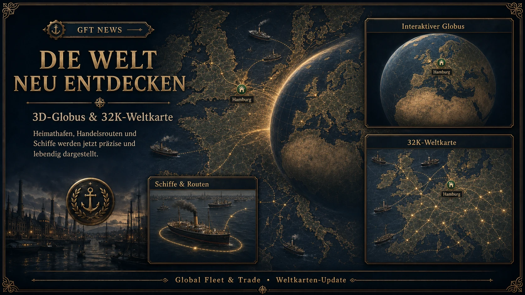
The world map now opens with a freely rotatable 3D globe. It provides a quick overview of the game world and marks the player’s home port directly. The name of the home port is displayed above its marker and follows the globe correctly as it rotates.
The globe can be rotated with the mouse and zoomed using the mouse wheel. Zooming in further creates a seamless transition to the high-resolution map view. The previously selected region remains at the center, making navigation feel like one continuous movement.
A Detailed 32K World Map
The enlarged map view is based on a high-resolution 32K world map. Coastlines, islands, rivers and sea regions therefore remain clearly recognizable even at closer zoom levels.
The transition between globe and map has been adjusted so that the 32K view begins one zoom level closer. This brings both views together more naturally and makes the change between them feel much smoother.
Ships and Routes Are Easier to Recognize
Ships at sea are displayed directly on their current routes. Their size now adjusts in a controlled way to the current zoom level. Even when viewing the map up close, ships remain visible and easy to select.
Different vessels are now scaled consistently regardless of the order in which their journeys began or the direction in which they are travelling. Their orientation follows the actual course of the route.
When a ship is selected, it receives a clear visual highlight. Simply moving the pointer across a ship keeps the map calm, while the ship’s name and important travel information can still be displayed.
Information at the Right Zoom Level
City names, harbor symbols and ships appear only when the appropriate zoom level has been reached. This keeps the large overview clean and readable. Trade and travel routes remain visible so that important connections are never lost.
Map controls have also been improved. The mouse wheel now continues to work when the pointer is positioned over ships or harbor symbols. These elements no longer block zooming in or out.
With this update, the world map is becoming a central part of Global Fleet & Trade. It no longer shows only places and routes, but makes the movement of the player’s fleet visible within one large, connected trading world.
Additional ports, ships, sea routes and details will expand this foundation step by step in future updates.
Welcome to the new world map of Global Fleet & Trade.
From the Globe to the 32K Map – The World Map Enters a New Dimension